 This documentation is released under the Creative Commons license
This module provides a very simple and less accurate geographic coordinate system without using OSG. It doesn't support orientation

The following diagram shows usage relationships between types. Unresolved types are missing from the diagram.
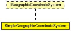
The following diagram shows inheritance relationships for this type. Unresolved types are missing from the diagram.
| Name | Type | Default value | Description |
|---|---|---|---|
| playgroundLatitude | double |
latitude coordinate of the playground origin |
|
| playgroundLongitude | double |
longitude coordinate of the playground origin |
|
| playgroundAltitude | double | 0m |
altitude coordinate of the playground origin |
| Name | Value | Description |
|---|---|---|
| display | i=block/table2_s |
//
// This module provides a very simple and less accurate geographic coordinate
// system without using OSG. It doesn't support orientation
//
simple SimpleGeographicCoordinateSystem like IGeographicCoordinateSystem
{
    parameters:
        @display("i=block/table2_s");
        double playgroundLatitude @unit(deg); // latitude coordinate of the playground origin
        double playgroundLongitude @unit(deg); // longitude coordinate of the playground origin
        double playgroundAltitude @unit(m) = default(0m); // altitude coordinate of the playground origin
}
This documentation is released under the Creative Commons license